Drain Field Installation & Repair · Monticello, GA
Drain field installation, repair and replacement for homes around Monticello and across Jasper County, Georgia.
- Lake Oconee & Lake Sinclair
- Residential & commercial
- 10% off: military & first responders
Get a free estimate
or call (678) 863-5620The short answer
What does drain field work around Monticello, GA involve?
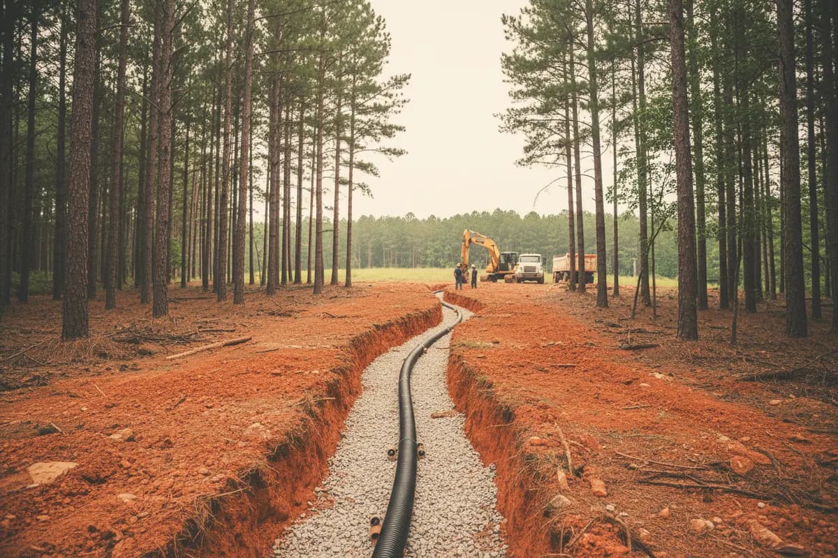
A new or replacement drain field in Jasper County is permitted and inspected by Jasper County Environmental Health in Monticello. The field has to fit soil that is often red clay on slopes, hold 100 feet from wells and 50 feet from water, and stay open until the county approves it. We trace the old lines, then fix or rebuild.↗↗
Reviewed by A Class Septic Services · Last updated
Soil & terrain
What's under a Monticello yard
Monticello sits on intermediate-to-mafic bedrock, the kind that weathers to dark red clay under a dark reddish-brown loam. Right at the city center NRCS maps Lloyd-Urban land complex on 2 to 10 percent slopes; out in the county, Lloyd clay loam and Pacolet sandy clay loam on 6 to 15 percent eroded slopes dominate.↗↗
Across the Jasper survey, NRCS rates about 72,300 acres of major soil components very limited for absorption fields and about 161,300 acres somewhat limited. Somewhat limited is workable: it usually means more trench, careful contour work and a layout that keeps roof water away, not a reason to give up on a conventional field.↗
- Pearson Creek and White Oak Creek
- Murder Creek
Lloyd↗
Largest component in Jasper (about 74,000 acres); Lloyd clay loam, 6-15% slopes, eroded is the biggest single map unit.
Pacolet↗
About 64,000 acres; the sandy clay loam phase on 6-15% slopes covers about 33,170 acres.
Chewacla↗
Frequently flooded floodplain silt loam, about 15,725 acres; not field ground.
- Soil series · USDA NRCS
Local facts
Field rules and local data for a Jasper County lot
Each row links to the agency, code or publisher it comes from. Tap a source to check it yourself.
| Topic | What it says | Source |
|---|---|---|
| Soil ratings (GA159) | About 72,300 acres very limited and 161,300 acres somewhat limited for septic fields | USDA NRCS Soil Data Access (SSURGO), survey area GA159 Jasper County |
| City-center soil | Lloyd-Urban land complex, 2 to 10 percent slopes | Same source as above |
| Bedrock | Intermediate-to-mafic rock weathering to dark red clay under dark reddish-brown loam | Wikipedia: Monticello, Georgia |
| Pacolet profile | Clay subsoil from a few inches down to about 18-30 in., then friable red and yellow saprolite; on eroded spots the clay is near the surface | USDA NRCS Official Series Description: Pacolet series |
| Shallow-rock ground to avoid | Wynott-Zion-Wilkes (6,735 ac) and Wilkes-Zion (4,420 ac) complexes, with bedrock as shallow as 38 cm (15 in.) | USDA NRCS Soil Data Access (SSURGO), survey area GA159 Jasper County |
| Wilkes soft rock | Weathered rock typically 10 to 20 in. down, leaving almost no soil below a standard trench bottom | USDA NRCS Official Series Description: Wilkes series |
| Perc limits | 90 min/inch max on lots under 3 acres; conventional fields up to 120 min/inch on 3 acres or more | GA DPH Manual for On-Site Sewage Management Systems (March 2026), Section F: Dispersal Systems |
| Wells next door | Where lots use private wells, fields hold 50 ft from property lines unless 100-ft well separation is kept | Same source as above |
The Monticello story
Acreage helps, and Jasper has a lot of it
Jasper's rural parcels give a field room that tight lake lots don't. The state lets conventional fields on three acres or more use slower-percolating soil than smaller lots can, which opens up options on the larger farm and timber tracts around the county.↗
Where an old field has given out, we look first for a cause upstream: a tank that hasn't been pumped, a box tipped downhill, gutters dumping onto the lines. If the trenches are done, the new field goes into undisturbed ground, which the rules require you to have set aside for a full replacement.↗
Clay punishes impatience. Trenches dug wet smear shut, so after a soaking rain we let the ground firm up before cutting.↗
Jasper's rural parcels give a field room that tight lake lots don't.
What it costs
What field work tends to cost
Full septic system with field (typical)
$3,590 to $12,463
Typical market range — HomeAdvisor: Septic System Installation Cost (updated Jun 20, 2026), 2026
Leach field failure from bad repairs
up to $20,000
Typical market range — HomeAdvisor: Septic Tank Repair Cost (updated Jun 19, 2026), 2026
Typical septic repair
$627 to $3,041
Typical market range — HomeAdvisor: Septic Tank Repair Cost (updated Jun 19, 2026), 2026
What moves the price
These are third-party typical market ranges, not our prices. Every job is quoted after we see it — estimates are free.
Free estimate: (678) 863-5620- 01Trench footage needed for the clay's percolation rate
- 02Room left for a replacement field on the lot
- 03Whether a pump or dosing tank is needed
- 04Restoring pasture or lawn over the new lines
Services here
Services connected to field work in Jasper
- 01Septic repairTanks, baffles and boxes that ruin a field when ignored.Septic repair details
- 02French drainsPulling hillside water away from the lines.French drains details
- 03Septic pump systemsDosing long fields or reaching higher ground.Septic pump systems details
Also available:Aerobic systemsDrip systems
Nearby areas
Drain field work around Monticello
FAQ
Drain field questions around Monticello
Straight answers, with the rule or record behind them. Still unsure? Call and ask the crew that digs.
(678) 863-5620Is Jasper County soil OK for a conventional drain field?
Often, with care. NRCS rates far more of Jasper's major soils somewhat limited (about 161,300 acres) than very limited (about 72,300), so many lots take a well-laid conventional field.
Source: USDA NRCS Soil Data Access (SSURGO), survey area GA159 Jasper County
I have five acres near Monticello. Does that help?
It can. On lots of three acres or more, Georgia allows conventional fields in soil that percolates as slowly as 120 minutes per inch, versus 90 on smaller lots.
Source: GA DPH Manual for On-Site Sewage Management Systems (March 2026), Section F: Dispersal Systems
How far does my field have to be from my well and my neighbor's?
At least 100 feet from any well. Where properties use individual wells, fields also hold 50 feet from property lines unless the 100-foot well separation is otherwise kept.
Source: GA DPH Manual for On-Site Sewage Management Systems (March 2026), Section F: Dispersal Systems
Do I need Jasper County's approval to replace field lines?
Yes. Repairs and replacements must be permitted and inspected, and nothing gets backfilled until the county signs off.
Source: Ga. Comp. R. & Regs. r. 511-3-1-.03, General Requirements (LII)
Why is the ground in Monticello so red?
The town sits on mafic bedrock that weathers to dark red clay, mapped as Lloyd soil.
Source: Wikipedia: Monticello, Georgia
Can roof water ruin a drain field?
It can overload one. DPH requires fields to be protected from excess surface water, including stormwater and gutter discharge.
Source: GA DPH Manual for On-Site Sewage Management Systems (March 2026), Section F: Dispersal Systems
Sources
Where these facts come from
Rules, costs and local facts on this page link to the agency, code or publisher that states them. Cost figures are third-party market ranges, not our prices — estimates are free.
Reviewed by A Class Septic Services · Last updated
- 1North Central Health District: Jasper County Environmental Health Department
- 2Ga. Comp. R. & Regs. R. 511-3-1-.07, Absorption Fields (LII)
- 3Wikipedia: Monticello, Georgia
- 4USDA NRCS Soil Data Access: map unit at Monticello city center (33.2959, -83.6866)
- 5USDA NRCS Official Series Description: Pacolet series
- 6USDA NRCS Official Series Description: Wilkes series
- 7GA DPH Manual for On-Site Sewage Management Systems (March 2026), Section F: Dispersal Systems
- 8HomeAdvisor: Septic System Installation Cost (updated Jun 20, 2026)
- 9HomeAdvisor: Septic Tank Repair Cost (updated Jun 19, 2026)
- 10Ga. Comp. R. & Regs. r. 511-3-1-.03, General Requirements (LII)
Ready when you are
Lines giving out in Jasper County? We'll trace them and tell you straight.
Send the address and what you're seeing. We'll find whether it's the field or something upstream, and plan the fix with the county permit.
(678) 863-5620- Lake Oconee & Lake Sinclair
- Residential & commercial
- 10% off for military & first responders
Free estimate
or call (678) 863-5620