Drain Field Installation & Repair · Lake Sinclair
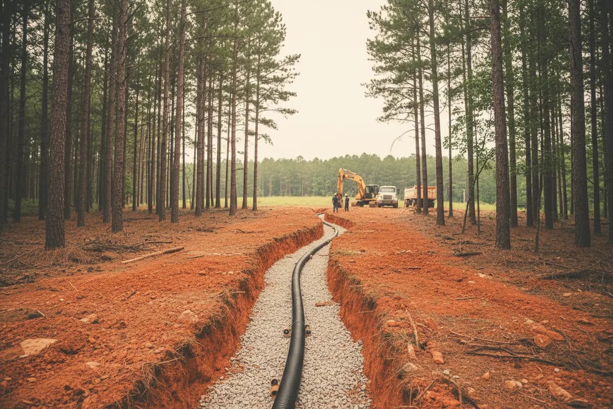
Drain field installation and repair at Lake Sinclair, where red Davidson clay and shallow Wilkes rock decide where a field can go.
- Lake Oconee & Lake Sinclair
- Residential & commercial
- 10% off: military & first responders
Get a free estimate
or call (678) 863-5620The short answer
What decides where a Lake Sinclair drain field can go?
Putnam, Baldwin or Hancock County Environmental Health sets the field location from a soil evaluation, and the field must sit at least 50 feet from the lake's normal water level. On Georgia Power lease lots the field and its repair area must stay on the lot. A Class Septic digs, lays and rebuilds fields to that permit.↗↗
Reviewed by A Class Septic Services · Last updated
Soil & terrain
The soils under Sinclair's shore
Putnam and Baldwin share one NRCS soil survey, and Davidson clay is its biggest component. It's dark red, heavy and well drained, with rock usually deeper than five feet. Plenty of Sinclair lots sit on it, and trenches there need to be dug level and kept shallow enough to stay in the better soil.↗↗
Wilkes is the trouble soil. NRCS maps it widely on 10 to 25 percent slopes, and DPH's soil table puts hard bedrock 40 to 60 inches down. A conventional trench needs two feet of soil under its bottom, so a Wilkes lot can run out of depth fast.↗
- Little River arm
- Rocky Creek Branch
- Island Creek arm
Davidson↗
Largest soil in the Baldwin-Jones-Putnam survey; deep red clay, rock beyond 60 inches.
Wilkes↗
Hard rock at 40-60 inches, slopes up to 60%; DPH code N calls for intensive investigation.
Cecil↗
Code A in DPH's table: suitable with proper design.
Cataula (Hancock side)↗
Seasonal water 24-48 inches down; code C, may need a special design.
- Soil series · USDA NRCS
The Lake Sinclair story
Why a replacement field is harder here than the first one was
The original field got the best soil on the lot, often decades ago. When it fails, the replacement goes into whatever is left, and on Sinclair that ground is boxed in by the 50-foot line from normal water, the house, the well or water line, and on leased lots the lease boundary.↗
Steeper lots narrow it again. DPH won't allow absorption fields on slopes above 25 percent without a soil classifier's special study. Area fill, a common fix for thin soil, isn't used on slopes over 12 percent, which rules it out on much of Sinclair's shore.↗↗
On the record
- DPH's Table 2.C gives Wilkes soils suitability code N, meaning intensive investigation is required and the system may have to go in before the house is built.↗
- In the Baldwin-Jones-Putnam survey, NRCS rates roughly 381,500 acres of major soil components very limited for septic absorption fields.↗
- When Sinclair's inflow drops below 250 cubic feet per second, Georgia Power releases Lake Oconee water to hold Sinclair at 338.2 feet plant datum.↗
Permits · Putnam, Baldwin or Hancock County Environmental Health (North Central Health District)
From soggy field to new field
- 01
Find the failure first: a crushed line, a sunk distribution box or a clogged trench each needs a different fix.
- 02
Have the soil evaluated where the new trench would go, and look for Wilkes rock before committing.↗
- 03
Get the repair permit from the county office for the lot; Baldwin's is on Ireland Drive in Milledgeville.↗
- 04
Stake the field 50 feet from normal water, 100 feet from any well, and inside the lease lines.↗
- 05
Dig on contour, keep machines off the new trench bottoms, and call for inspection before cover.
Georgia rule Ga. Comp. R. & Regs. r. 511-3-1-.07
“not less than fifty feet (50') from geothermal boreholes and the normal water level of any impoundment”
What it costs
Field costs for scale
Field failure caused by a poor repair
up to $20,000 to fix
Typical market range — HomeAdvisor: Septic Tank Repair Cost (updated Jun 19, 2026), 2026
Drip system where trenches won't fit
$8,000-$18,000
Typical market range — HomeAdvisor: Septic System Installation Cost (updated Jun 20, 2026), 2026
Whole conventional system
$3,590-$12,463
Typical market range — HomeAdvisor: Septic System Installation Cost (updated Jun 20, 2026), 2026
What moves the price
These are third-party typical market ranges, not our prices. Every job is quoted after we see it — estimates are free.
Free estimate: (678) 863-5620- 01Depth to Wilkes rock in the spot left for the new field
- 02Slope, and whether the trenches can follow the contour
- 03How much lot is left after the 50-foot lake line
- 04Hand work near docks, walls and old trees
FAQ
Lake Sinclair drain field questions
Straight answers, with the rule or record behind them. Still unsure? Call and ask the crew that digs.
(678) 863-5620How far from Lake Sinclair must a drain field be?
At least 50 feet from the lake's normal water level, and 100 feet from wells and springs.
Source: Ga. Comp. R. & Regs. r. 511-3-1-.07, Absorption Fields (LII)
What is Wilkes soil, and why does it matter?
It's a Piedmont soil common on Sinclair's slopes with hard rock 40 to 60 inches down, which leaves little room under a trench.
Can my new field go on the Georgia Power strip below my lease lot?
No. Georgia Power requires the system and its repair area to be sited with no disturbance to the project boundary.
Source: Georgia Power: Lake Sinclair Dwellings and Additions guidelines (PDF)
Can fill dirt fix a thin-soil lot near the lake?
Sometimes on gentle ground, but DPH doesn't use area fill on slopes steeper than 12 percent.
Source: GA DPH Manual for On-Site Sewage Management Systems (March 2026), Section H: Site Modifications
Does Lake Sinclair's water level move much?
Not much. Sinclair is Wallace Dam's lower reservoir, and in low flow Georgia Power holds it at 338.2 feet plant datum so pumpback keeps working.
Is a drain field allowed on a steep lake lot?
Not on slopes over 25 percent, unless a soil classifier's special investigation shows the limitation can be overcome.
Source: GA DPH Manual for On-Site Sewage Management Systems (March 2026), Section B: General Site Provisions
What soils are on the Hancock side of the lake?
NRCS maps Cataula and Cecil as the largest components in Hancock's survey; Cataula has seasonal water 24 to 48 inches down.
Source: USDA NRCS Soil Data Access (SSURGO), survey area GA639 Hancock and Taliaferro Counties
Nearby areas
Drain field work near Lake Sinclair
Sources
Where these facts come from
Rules, costs and local facts on this page link to the agency, code or publisher that states them. Cost figures are third-party market ranges, not our prices — estimates are free.
Reviewed by A Class Septic Services · Last updated
- 1Ga. Comp. R. & Regs. r. 511-3-1-.07, Absorption Fields (LII)
- 2Georgia Power: Lake Sinclair Dwellings and Additions guidelines (PDF)
- 3USDA NRCS Official Series Description: Davidson series
- 4GA DPH Manual for On-Site Sewage Management Systems (March 2026), Section C: Soil Information, Table 2.C
- 5GA DPH Manual for On-Site Sewage Management Systems (March 2026), Section B: General Site Provisions
- 6GA DPH Manual for On-Site Sewage Management Systems (March 2026), Section H: Site Modifications
- 7USDA NRCS Soil Data Access (SSURGO), survey area GA604 Baldwin, Jones, and Putnam Counties
- 8Federal Register, June 18, 2018: FERC notice, Wallace Dam Hydroelectric Project relicensing application
- 9North Central Health District: Baldwin County Environmental Health Department
- 10HomeAdvisor: Septic Tank Repair Cost (updated Jun 19, 2026)
- 11HomeAdvisor: Septic System Installation Cost (updated Jun 20, 2026)
Ready when you are
Field soggy again after rain? Find the rock before you pick the spot.
Send the address and, if you have it, the old permit drawing. We'll trace the failure and walk the ground that's left for a replacement that clears the lake line and the lease.
(678) 863-5620- Lake Oconee & Lake Sinclair
- Residential & commercial
- 10% off for military & first responders
Free estimate
or call (678) 863-5620